This tutorial explains how to overlay historical maps on top of current maps in Google Earth. There is a useful feature of image overlay in Google Earth which is very good for geography teachers and professors. If you are one of those and want to display some historical map on top of modern map in Google Earth then I will show you how to do that.
Basically, you can download a historical map from any website such as Library of Congress and then use the overlay feature of Google Earth Pro to show it on top of current map. It offers all the tools that you will need to fix the alignment. After you have perfectly aligned the map, you can tweak its opacity for the sake of comparison.
After creating an overlay of map, you can even share the same view with anyone. Google Early lets you save the overlayed map as KMZ file. Or, you can email it directly from Google Earth. A much simpler step by step process is mentioned below.
How to Overlay Historical Maps on Current Maps in Google Earth?
- Download and install Google Earth Pro from here. Pro here is not meant for paid or premium, it’s just the name of the software.
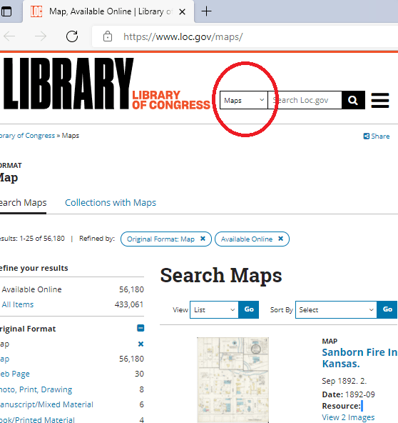
- Now, you can download a historical map of any place. You can use Library of Congress for that.

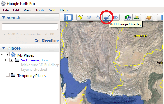
- Now, open the same location you want to show on current map. After that, select Overlay image option from the toolbar.

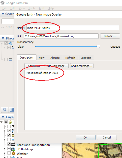
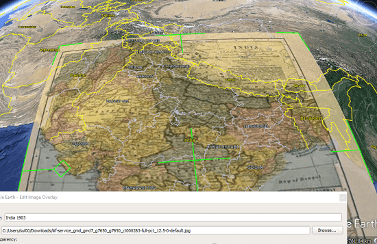
- Now, specify the downloaded image of historical map. Give your overlay a name and specify a description.

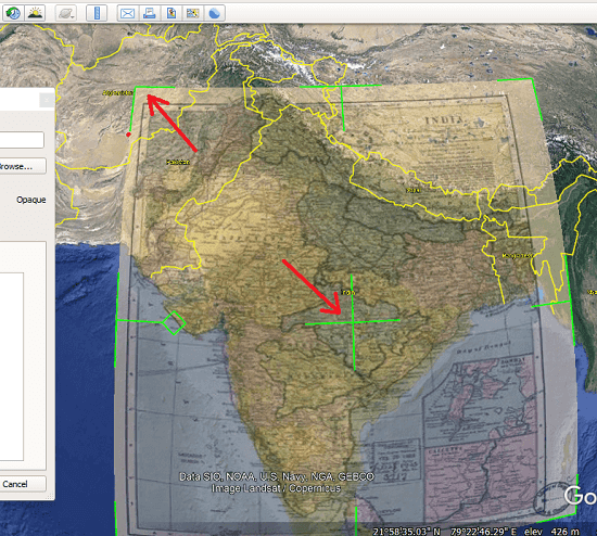
- Now, you adjust the map that you just uploaded to Google Earth. There are options to expand it and change its orientation. While aligning the map, you can control its opacity to have a perfect view of the boundary beneath the overlayed image.

- Finally, when you are done, you can compare the both maps, their boundaries, enclosed regions, and places. This is as simple as that.

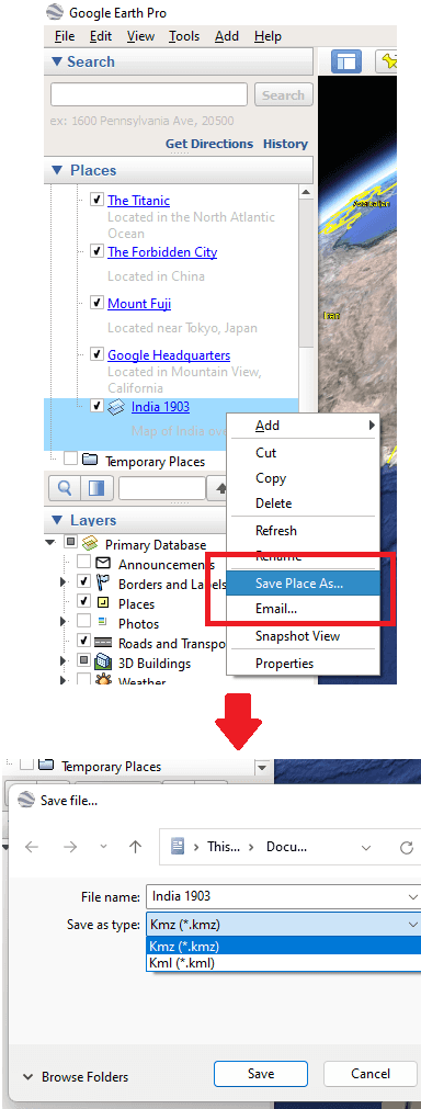
- Next, you can save the map as a place in KMZ file. Just right click on the overlay from the left side and then select “Save as” option. And from the same menu, you can send the overlayed map to anyone via email.

In this way, you can now display a historical image on top of modern map using Google Earth. This overlay feature is amazing and it is really a great way of teaching students during an online class.
Final thoughts:
If you are looking for a way to display a historical map on top of modern map then this tutorial will help you. Just get Google Earth and then simply follow the steps I have mentioned above carefully. As for historical maps, you can download them for anywhere and use them. Just make sure that you download them in high resolutions.