FloppyGIS is a free shapefile viewer software for Windows. Using this software, you can view any shapefile having format SHP. You can see all the geographical details of the region you click on the shapefile. You can manipulate a shape file by changing the boundary color, fill color, set scale, etc. Also, the software comes with various tools such as zoom, pan, to use on a shapefile. You can add multiple shapefiles in it and save your project as XML files.
Shapefiles are nothing but the vector graphics files which are created to be used in GIS software. Shape files save geographical data corresponding to a particular region on a map. Shapefiles can be of the world or a county map. And in this article, I will explain about a software that helps to read those files.
Using FloppyGIS freeware, you can create a project and various shapefiles on it. And once you are done, you can save your project as an XML file. So, to cut to the chase, let’s see what it takes to use this free shapefile viewer software.
How to View any Shapefile using this free Shapefile Viewer Software For Windows?
FloppyGIS is one of the best free software out there to view shapefiles. Not only this, you can also add many shapefiles in your project at once and save them as XML files. The software is smart enough to read a shapefile and tell you the correct geographical location where you click on any region of the shapefile. FloppyGIS allows you to change the outline fill color of the shapefile, set scale, etc.
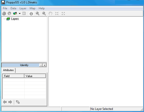
Step 1: Install FloppyGis on your PC by downloading it from here. And when you launch it, you will see its interface as showing in the following screenshot.
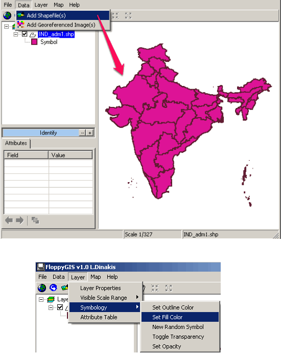
Step 2: Use Data > Shapefile menu to add a shape file that you have. After adding the shapefile, you will see that it will appear on its interface. You can use the Layer > Symbology menu to change the boundary and fill color.
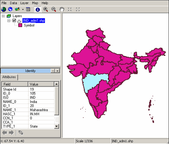
Step 3: Click on any region to see the corresponding geographic details of it. Also, you can view all the attributes of the SHP file you just have imported in a tabular format using the Layer > Attribute table menu option.

So, in this way you can easily view and organize shapefiles using FloppyGIS. The software is quite intelligent to determine the geographic locations from your shapefile.
Conclusion
FloppGIS makes it pretty easy to view shapefiles of the world and countries. You can easily view and organize shapefiles and save them as separate projects. Also, the software allows you to add Geo-referenced images to your project. So if you are looking for a decent Shapefile viewer software for Windows, then FloppGIS is a very good option.