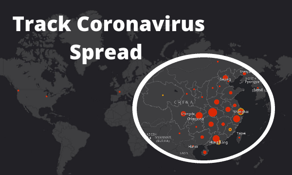
This article covers an interactive map to track Coronavirus spread in real-time. Coronavirus is a new virus that appeared in Mainland China during December 2019. The first case appeared in Wuhan from where the virus started spreading. Now, there are over 1000 confirmed cases of this virus leading to 41 deaths so far. At this point, it spread to the eastern half of China with new cases appearing to other countries as well including Hong Kong, Thailand, Singapore, Malaysia, France, Taiwan, Japan, South Korea, Macau, Vietnam, US, Australia, and Nepal.
This virus came from animals, the particular bread hasn’t been determined yet but there are speculations that it came from snake. It can spread from an infected person to other people who are in close contact with the infected person. Researchers say that a Coronavirus infected person can infect 1.4 to 2.5 people although we don’t know at what rate it can spread.
This virus causes pneumonia-like illness where the lungs get infected and can lead to life-threatening conditions. It spreads from sneezing or coughing. The symptoms of this virus (as appeared in diagnosed people) are fever, cough, and breathing difficulties. The severe condition of this virus outbreak quickly informed to WHO and the governments and researchers all around the world are trying to contain the infection and working on a cure. If you want to know where this virus has spread so far, you can check that with this interactive map.
Also read: Interactive Climate Change Map to Visualize Climate Impact
Track Coronavirus Spread with this Interactive Map
This map is created by US researchers and gets real-time updates whenever a confirmed or suspected case is reported. It shows you the spread of the Coronavirus on top of a world map. It marked the confirmed reported cases with red color and suspected cases with yellow color. The size of the mark represents the number of cases at a particular location. You can interact with the map to track the spread all over the world.
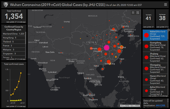
The map is accompanied by information panels on each side. Left to the map, it shows you the number of total confirmed cases reported so far. Below that, it shows you a list of confirmed cases by countries. You can click a country from the list to locate the reported cases on the map. It also shows a graph of the confirmed cases over time that showcase the spreading rate of this virus.
Right to the map, it shows the total number of deaths so far along with the number of total recoveries. Below that, it lists all the affected locations along with a total number of confirmed and suspected cases.
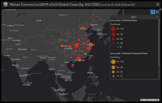
All sections of this map are expandable. At the top right corner of each section, you get a button to expand the section to the full screen. You can expand the map to full screen and change the base map as well. You can also view map legend to know the scale of each affected location.
Wrap Up
This interactive map gives you insight into the overall spread of coronavirus all over the world. You can use this map to check the affected locations. If you are planning to travel somewhere, you can check if that location is affected by the virus and take appropriate precautions. The general precautions for this are the same as flu, cover your mouth when you cough, wash your hands and avoid coming in long contact with infected people.