Shapefiles (.SHP) are the vector graphic files which are used in GIS software. This article talks about a free online shapefile viewer, Mapshaper. Mapshaper is a website with various online mapping tools. You can open different map file formats on Mapshaper, such as KML, GPX, GeoJSON, CSV, SHP, and more. Not only open, you can edit some of these formats and export them to download to your computer. You can export one file format to other file formats, i.e. you can convert a file format into other format and export it to your computer.
Thus, Mapshaper serves as a viewer, editor, and converter for many map file formats. You can import a shapefile in Mapshaper and use it as an online shapefile viewer. Furthermore, you can interact with that shapefile, perform various tasks on it and can export it in any of the following formats: Shapefile (SHP), GeoJSON, TopoJSON, CSV, and SVG.
And, if you are looking for a shapefile viewer software, you can view our article on that here.
Best Free Online Shapefile Viewer: Mapshaper
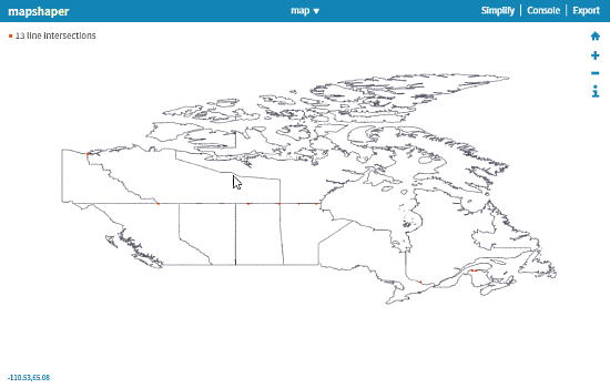
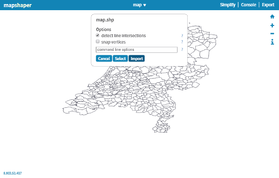
To view shapefiles online at Mapshaper, go to mapshaper.org. Drag or browse the shapefile that you want to view. A pop-up will show on your screen with options for line intersections detection and snap vertices. Select the options as per your need and click Import button to open the shapefile. You can import multiple files here, but can only view one at a time.
Apart from opening the shapefiles, Mapshaper has three tools to further help you out. These tools are described below:
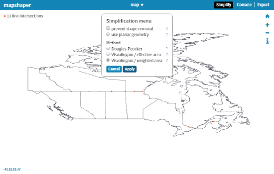
Simplify
As the name suggests, this tool simplifies a shapefile. It gives you a simplification scale which you can adjust from 0-100 as per your needs. Increasing the simplify level straightens the boundary lines to make the shape less complex.
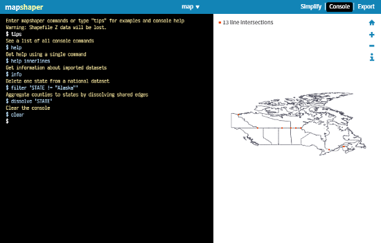
Console
Clicking on the Console button opens a console window in the Mapshaper. You can run various Mapshaper commands here. The console has following types of commands:
- I/O Commands
- Editing Commands
- Experimental Commands
- Informational Commands
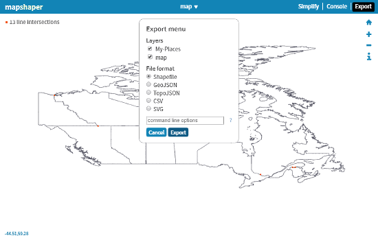
Export
This is for downloading the opened shapefile to your computer. Here, you get various output formats for exporting your file. You can also add command line options, like set active layer, print information, etc. while exporting a file. Mapshaper can export a file into following formats:
- Shapefiles (Same)
- GeoJSON
- TopoJSON
- CSV
- SVG
View shapefile online at Mapshaper here.
Final Verdict
Mapshaper is a good online shapefile viewer. Calling it just an online shapefile viewer seems an over-simplification. It can do a lot of other tasks beyond opening shapefiles online. You can interact with your file, edit it, and can export it to various other formats as well.