This article covers a free 3D GPS app for mapping outdoor activities. This is a GPS-based app that lets you plan, record, and map outdoor activities on a 3D map. With this app, you can plan trekking, trail running, ski touring, paragliding or any outdoor activity on a 3D map by adding waypoints and creating a track. Or, you can map your activity on the 3D map by recording your route while doing it.
This app is created for adventurers who do outdoor activities. As most of the GPS tracking apps use flat maps which could be confusing in mountain areas. This app integrates the GPS-tracking with a 3D map (topology and satellite, both) that shows mountains and hills in 3D and hence provides better navigation. It also has a paid-tier that lets you download maps for offline use.
Also read: Best Free Google Maps to GPX Online Converter
Free 3D GPS App for Mapping Outdoor Activities
Relief Maps is a 3D outdoor GPS app that provides 3D maps with GPS tracking. This app is available for both, Android and iOS (links to the respective platform is provided later in the article). To use this app, you have to create an account first and verify your email address. Once that done, you can log into the app and start using it.
This app supported the following world map views:
- Relief Maps
- World Topology
- World Satellite
- IGN
- IGN Satellite
- USGS Topology
- USGS Satellite
You can switch between these maps anytime with the map layer button present at the screen on the top right corner.
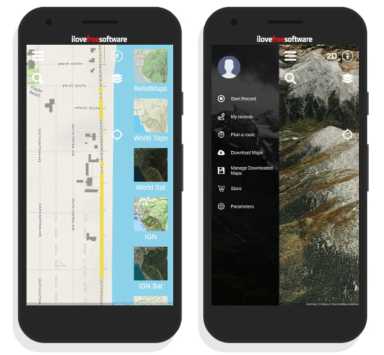
The navigation menu present on the left side has the following features:
- Start Record: To start recording your route on the 3D map.
- My Records: To view all your map records.
- Plan a route: To plan a trip on the 3D maps simply by adding waypoints.
- Download Maps: Download maps for offline use (available in Paid-tier).
- Parameters: To change the unit system for measurements.
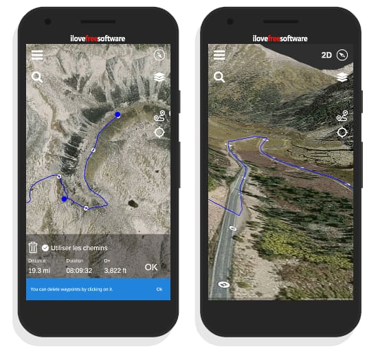
Recording a trip is super easy with this app. All you have to do is start the recording and it will track you using GPS, map the track and save to your account. From there, you can share your tracks with Relief Map community. You can also add new records to your account simply by importing a GPX file.
Planning a route is also a handy option that lets you plan your trip ahead. You can select waypoints on the map and this app finds the most appropriate route and creates a track for you. It shows total track distance, latitude, and track duration as well.
Get this app from Play Store here.
Get this app from App Store here.
Closing Words:
Relief Map is a nice app to record outdoor activities on 3D map which you can share with others. Personally, I really like the live track recording feature. With this feature, you can simply start the recording from the starting point and stop it on the destination to get the route of your journey on the map. If you are into outdoor activities, the paid-tier really worth trying, especially the offline maps feature that comes handy when there is no network coverage.