Military Maps is a website which offers free digitized archive of old military maps, prints, and drawings. These maps offered through this website have been collected by King George III which were digitized and published online for everyone to see. The website contains around 3000 maps, prints, and drawings.
These old military maps were originally stored in large Solander boxes which were capable of storing over 200 maps of sizes up to 470 x 330 mm. Some old maps were even larger than this dimension and could not be fitted in the box. Old maps were usually made on strong linen with brass fittings to hang them. They would also have silk ribbon on one side to roll up and tie the large maps.
Digitizing these maps and publishing them online gives everyone a chance to look at these maps easily. They can be referenced easily for academic needs.
When you open the website using the link given at the end of this article, you will see a page like the one shown in the screenshot above. Scroll down the page and you will land on the introduction of the website, as seen in the screenshot below.
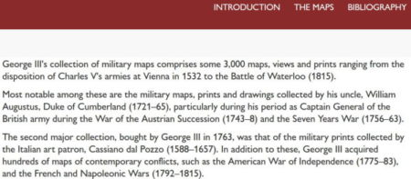
The introduction page mentions what all maps does the website contain and who was the original collector of the maps.
The maps have been published on the website in a chronological order. You can check out the “a guide to the online catalogue” under the introduction section of the website to know more about how the maps have been categorized online and which section contains what information.
The maps section which you can find at the top right side of the page will show you a page like the one seen below. This section shows you all the categories these maps have been divided under.
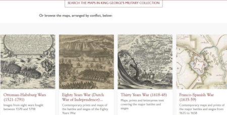
The collection of maps contains material ranging from 16th to 18th century. Searching through the website is possible by keyword, place name, people, or event name.
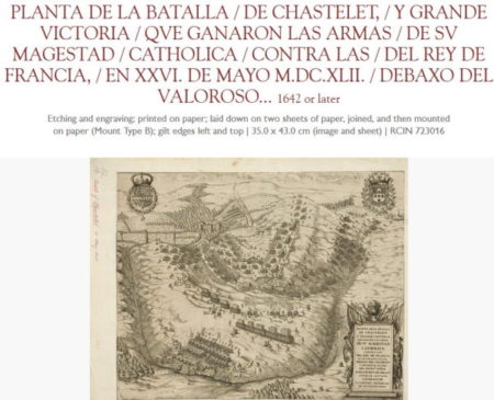
When you click on a category, you will find a brief description about the maps under that category. Each category is further divided into sub-categories. These sub-categories have maps and drawings available in them. All the maps and drawings will be listed in tile format. When you click open a map it will be accompanied by a title and description of the map. This can be seen in the screenshot above.
Overview:
Military Maps is beautiful website to go through if you are interested in history or for academic purposes as well. The website brings King George III’s beautiful collection online for everyone to view and explore the maps in detail. Even if you are not historically inclined these maps are just beautiful to look at.
Check out Military Maps website here.