This article covers free interactive historical topographic maps to view topographical changes over last 130 years. topoView is a free service that provides historical topographic maps of the world since 1980. These maps are produced by USGS and anyone can find and download these topographical maps to gain insight into the topographical changes that happened all around the world since 1980.
The service shows you a world map where you can select a country and search maps by location or name. Based on your input, it lists all the available maps and provides a slider to cycle through the time from 1880 to the present year. Then, you can filter the maps by time and scale and plot any map on top of the current map to observe the changes by adjusting the transparency. All the maps featured on this service can be downloaded in JPEG, GeoTiff, GeoPDF, and KMZ formats. Let’s check it out in detail.
Also read: Free Interactive Map of Ancient History Museums, Archaeological Sites
Free Interactive Historical Topographic Maps
To view the topographical changes over the last 130 years visit the topoView website and go to the “Get Maps” section. This takes you directly to an interactive world map where you can plot a historical topographic map on top and adjust the transparency to observe the changes.
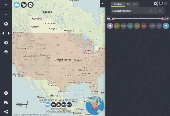
There is a panel on the left side of the map where you can search the historical topographic maps. You can search the maps either by entering a location or a map name. Below the search box, you get a slider ranging from 1880 to the present year. With this slider, you can find the maps within a specific time range.
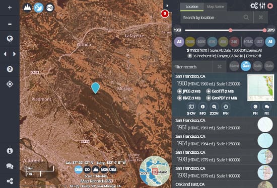
The search query returns with a list of available maps that you can filter by name, date, scale, and state. You can pick a map from the results or cycle through all the results using the navigation buttons present on the right side. Each listed map shows the name, year, location, download options. From there, you can download any map in JPEG, GeoTiff, GeoPDF, and KMZ format.
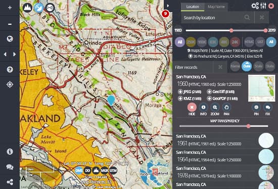
Below the download option, there is a Show button. This button plots the respective historical topographical map on top of the current map and gives you a slider to adjust the transparency of the map. By changing the transparency level, you can easily observe the changes between the historical map and the current map.
Browse the 130 years of topographical changes here.
Closing Words
topoView offers a valuable collection of historical topographical maps for free. These maps could be helpful to students, archaeologists, and researchers all around the world. And, the options to download these maps allow you to take them with you anywhere or use them with other geographical data or tools such as Google Earth.