This article explains how you can take photos of Earth from Space using the Canon satellite for free. You might know that Google Earth is one way to explore the Earth from space. But what you might not know is that Canon offers something similar. Canon has a website that offers incredible Earth views from space.
This website is powered by CE-SAT 1 (Canon Electric Satellite 1). CE-SAT 1 is a microsatellite that is developed by Canon Electronics and launched in the orbit with an Indian PSLV rocket in June 2017. Unlike Google Earth, this Canon website does not cover all the Earth instead it offers high-resolution Earth imagery that you can see and take photos of. With that said, let’s dive into details to know more about this Canon satellite.
Also read: Get latest Himawari satellite images in new chrome tab: Himawari 8
Take Photos of Earth from Space with Canon Satellite Free
The website to access the imagery from the Canon satellite is somewhat similar to Google Earth. It takes a few moments to load the data and then shows you the Earth rotating in space. It offers an interactive journey to various places on Earth with audio. Simply launch the journey on the website to get started.
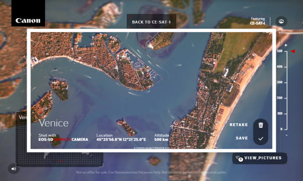
It starts with a video showing the capabilities of Canon Cameras. In fact, the satellite itself uses the Canon EOS-5D Mark 3 Cameras to capture all the imagery. It highlights the locations with available high-resolution imagery on the Earth. This includes 9 different locations covering
- Alaska
- Antarctica: To monitor ice cap status
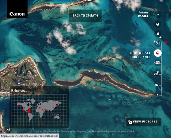
- Bahamas
- Black Rock City
- Dubai: Palm Jumeirah
- Japan: Canons Akagi Plant
- New York City: Monito traffic
- San Jose
- Venice
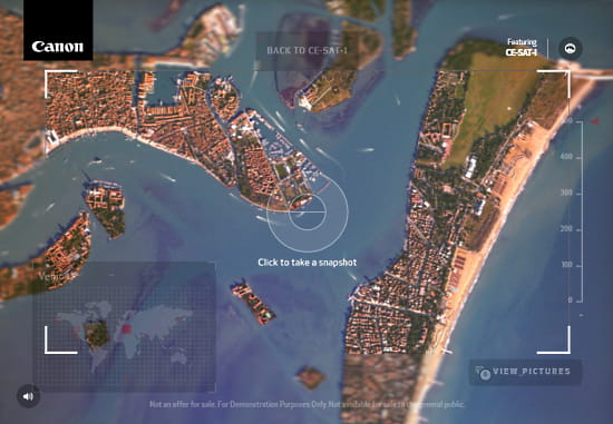
You can pick any of those locations and begin the expedition to explore those places. It is not just imagery but an interactive journey with video and audio where you get to explore the location from group to space. You can click on various things in the picture and interact with them. In the case of satellite imagery, you can zoom in at different levels. During that, it opens a viewfinder like an interface on the screen which you can use to take photos of the Earth.
Explore Earth with Satellite here.
Closing Words
This Canon website is a great way to explore and capture Earth from Space for free. It makes high-resolution Earth imagery easily accessible to everyone. Along with that, it also demonstrates what a Canon camera can do and allows you to track see melting ice caps, track wildfires, ocean pollution, traffic management, and much more.