During the Covid pandemic and even in the post-pandemic era, being outdoors has become increasingly popular. It doesn’t matter whether it’s running, cycling, skating or any similar outdoor activity. But such outdoor activities are packed with some natural challenges such as how to plan the route, how to precisely measure its distance, how to track the run correctly, how to gauge your performance and more.
There are a number of free and paid applications to track and plan your routes. This is extremely important for people who are new to running. Planning your route gives you a precise idea of how far you will run. In the absence of this, people tend to under – or overestimate their activity and this leads to a lower success level. Without a fixed distance that one may have planned, runners and cyclists are prone to give up and lose hope faster. Even proficient runners should plan their route before it starts and keep measuring it during the run using a suitable time scale.
In this article we will be exploring 5 applications that enable you to plan a running route.
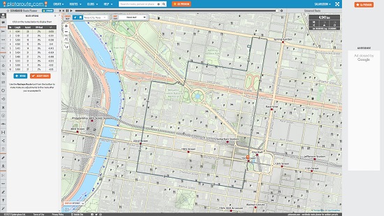
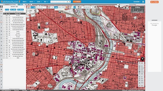
1. Plotaroute.com
This is a free Route planning website for outdoor pursuits including Running, Walking & Cycling. Plotaroute boasts of some of the best recreational maps in the word from Open Street Maps (Trails & Cycles), Ordnance Surveys, Accuterra and more. You cab examine the road surfaces, hills & other terrains, and use Google Street View to plan routes that are tailored to your needs.
Plotaroute provides you with 4 methods to create your routes. Traditional route planner allows you full control to plan your route in fine detail. Alternatively, you can choose the places (waypoints) to visit and let the website work the routes between them. Also, you can use the Make me a Route feature and tell how long you want your route to be, and the website will offer 10 suggestions based on it. Additionally, you can import a route that you may have recorded on your GPS device or created on another application and upload it to Plotaroute.
Further, to make changes to the route, you can use the powerful and extensive range of route editing tools such as Split, which splits one route into multiple ones, Merge that combines more than two routes into one, Crop that can shorten a route by moving the start / finish points, Delete that allows you to delete a chosen section of the route, Shrink that enables you to eliminate the redundant points and many more.
Plotaroute allows you to create Radius Maps so that you can see where you can reach in a certain time or distance. You can easily annotate the maps by adding custom labels and symbols to enrich them, upload photos of your route to the map and directions and share the map on your website, export to GPS devices or print customized route guides.
Plotaroute also provides a Mobile App that is adapted for small screens. The Mobile App supports voice navigation using which you can convert your device into recreational satellite navigation system.
Click here to navigate to Plotaroute. You must remember that not all of the above features are available in the free version.
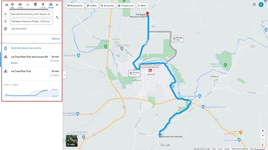
2. Google Maps
One of the simplest and most popular online tools to plan a running or cycling route is Google Maps. Almost all the users know this app very well and have probably used it at some point or already using it. You can easily plan your running or cycling route using Google Maps.
The best way is to use the native route planner where you can enter the start and end points of your route and Google Maps will automatically create and display it for you. You can customize the suggested path by configuring one or more stopovers if required and finally the walking / cycling distance is shown to you as the total length of your planned route.
The best way to plan a route using Google Maps is to launch the website, click on the desired location for the pin to appear, add as many way points as you like using mouse clicks on the chosen locations and the total distance is measured and displayed automatically.
Click here to navigate to Google Maps.
3. MapMyRun
This is a neatly designed application that enables you to easily track your runs and is remarkably good at panning routes as well. It boasts of a simple tracker that calculates the distance and speed of your run. Click on the link that we have provided below to navigate to MapMyRun.
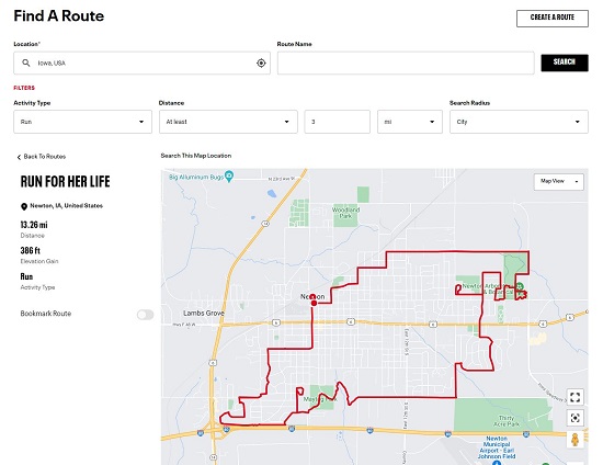
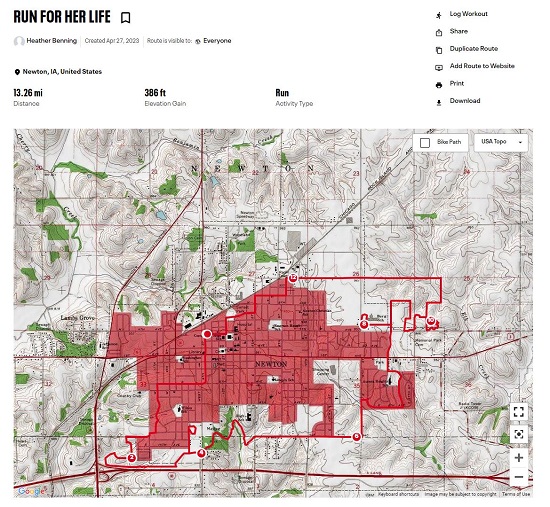
One of the best features of this product is the awesome route planning option. Just sign up and create a free account and use the simple intuitive tools to create your route maps. You can save and send the maps to your phone and then proceed to run along with it. Apart from creating your own routes, you can also search for routes that have bee explored by others, filter them by your present location, how much distance you wish to cover and more. This is particularly important for those people who are away for work or travel and do not have much idea where to go for a run or trail.
MapMyRun offers a lot more features too such as a training diary where you can log all your physical activities like running, swimming, yoga and more and track you progress towards the goals that you have set. IT also boasts of inbuilt training plans that are very handy for beginners.
Click here to navigate to MapMyRun.
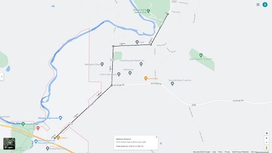
4. On The Go Map
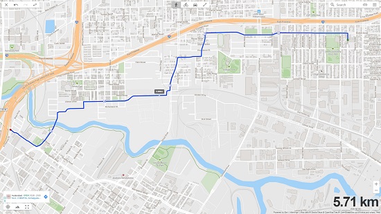
Let’s move on to the next website the basic idea behind which is that you should be able to just click points on a map and go on adding up the distance. On the Go Map automatically connects the two points by calculating the shortest walking / cycling path between the two.
Just click on the link that we have provided and start clicking the chosen points to automatically create a route. On The Go Map is accurate for anything beyond 0.1 miles. The tool boasts of improved path following techniques hence its better than simple clicking points on Google Maps. But sometimes you may have to manually override the routes to ensure accuracy because the application does not have a lot of settings to understand when to prefer a certain type of run or a different surface or topology.
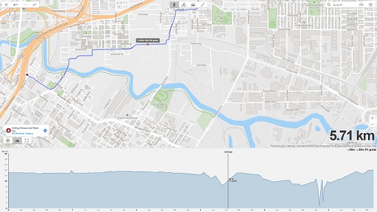
You can also enable the elevation profile to find out the topology of the surface all along the walking, running or cycling path
On the whole, On The Go Map ca be considered as a good option to find out how far you can run and what route you should follow.
Click here to navigate to On The Go Map
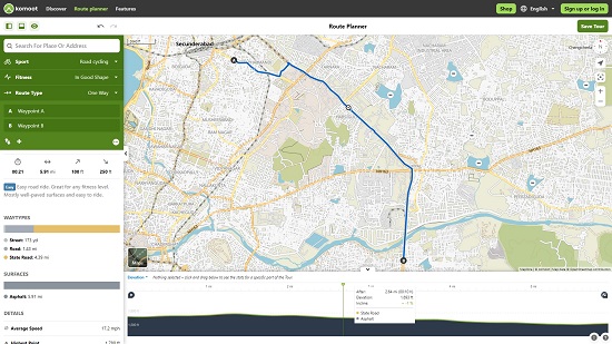
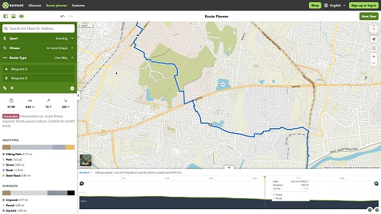
5. Komoot
This is yet another online application especially developed for people who are into running, cycling, mountain biking and more. All that you need to do is click through to a route and it gets automatically displayed on the screen on a map with distance, expected time, ascent, terrain profile and more. Click on the link that we have provided below to navigate to Komoot.
The Route Planner page lets you plan your route by selecting a start and finish point as well as any number of waypoints in between. Komoot then intelligently plots the route for you based on your selected sport such as walking, cycling, hiking etc as well as fitness level. The application also boasts of a wide range of pre-planned routes that you can choose to make a start.
Komoot map is based on Open Street Maps with contours, paths, hill shading and more. A lot of hiking highlights are displayed on the map that you can include in your routes if needed. The app has the added feature of importing and exporting GPX maps. You can also record your tours with descriptions, highlights, photos, geotagged locations and more.
Overall, Komoot may not be the application to choose if you want total control over your route planning., but it’s fantastic for a casual use. Click here to use Komoot.
Closing Comments:
Go ahead and spend some time with each of the above websites that we have explored and use the one that best suits your needs. The most powerful of all the above tools that provides absolute control over your route planning and tracking is the first one in the list namely, Plotaroute.com