In this article, I’m covering a free global sprawl map to check street connectivity. The Street-Network Sprawl Map allows you to explores the most sprawl cities from various countries and how it has changed over time. Sprawl is basically a measure of the connectivity of the streets. It uses a color scale to visualize the poorly connected to well-connected areas all around the world.
This map is based on the OpenStreetMap and uses the OpenStreet road data to measure the sprawl over time. This is an interactive map where you can zoom anywhere to explore the street connectivity in the area. You can explore the map for sprawl index, circuitousness, cul de sacs, and 1 & 3 ways. You can map the map cumulative or select a particular year to check the sprawl. On top of that, you can also jump to randomly-chosen locations based on the sprawl type.
Also read: Free Library of OpenStreetMap Tiles to Display Map Data with Unique Layouts
Free Global Sprawl Map to Check Street Connectivity
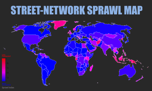
This global sprawl map shows the average street-network around the world. It has a connectivity scale on the bottom left corner. The poorly connected streets where you have to carry private vehicles are the red area on the map. Whereas, well-connected streets where you can walk or take public transport easily are blue areas on the map.
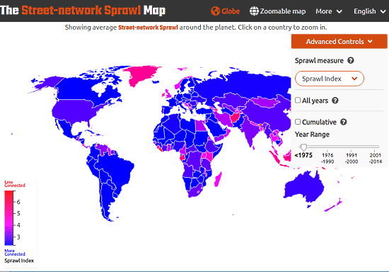
This map is fully interactive, you have to move it around to explore any locality on the planet. On top of that, it is zoomable to the level of the streets. There are a bunch of controls on the top right side. One control is Sprawl measure where you can pick a sprawling type to visualize that on the map. It offers four following sprawl measures:
- Sprawl index
- Circuitousness
- Cul de sacs
- 1 & 3 ways
Below that, you get an All years option that shows the latest data on the map. There is a Cumulative option as well where you can pick a range or particular year to get the respective data.
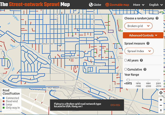
You can zoom in on any locality on the map to explore the street-network. All the streets are color-coded to easily distinguish the street-network type. At this level, you can analyze the routes for the commute. And if you are there just for exploration then this map has a random jump option where you can pick a street-network type. It takes you to a random location with the selected street-network. Here is a list of street-network types you can jump to:
- Dendritic
- Disconnected
- Circuitous
- Deadends
- Broken-grid
- Degree-3
- Irregular-grid
- Grid
Wrap Up
This Global Sprawl Map allows anyone to explore the street-network all around the planet. It is handy for educational purposes as well as for personal use. You can use this map to explore a locality and check out the street network. Then you can know which street is walkable, connected, looped, or deadends. You can also use it to decide whether you can get public transport there or have to take a personal vehicle.