NASA WorldView lets you view real-time NASA satellite imagery. You can use this website to see almost real-time images from various NASA satellites and also download the imagery. The satellite imagery that it shows would have been updated within just 3 hours of observation! So, the imagery that you see on this website is pretty real-time.
The website itself is pretty easy to use and behaves a lot like Google Earth. You start by visiting its website and browse the Earth’s imagery that is captured by NASA’s Earth observing satellites. You can browse the whole map of Earth by just dragging and zooming on it, and then you can take a screenshot of any part of the imagery and download it as a whole. There’s also a timeline given to view and download images of Earth on a particular date of past.
Sometimes, you want to view imagery of various phenomenons that are going on at various places of Earth. That’s where WorldView comes in handy. Using this tool, you can view Storms, Fire, Flood, Ash Fumes, Vegetation, Smoke, and many other phenomenon in almost real-time. It’s very interesting to view all these things via WorldView, and take their screenshot to download and share with others.
Let’s take a deeper dive into this opensource NASA project.
How to View Real-Time NASA Satellite Imagery Using WorldView ?
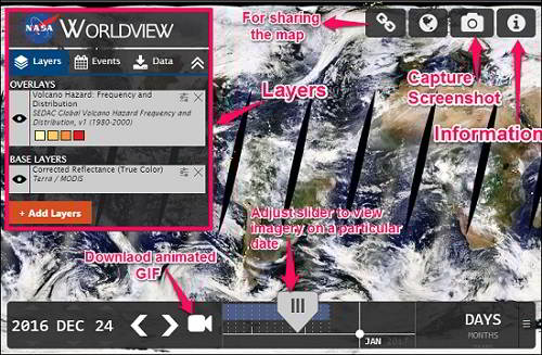
If you have ever used Google Earth, then you are completely at home with WorldView. Just like Google Earth, it shows a geographical map of earth with various options for viewing it such as zoom, rotate, etc. On the right side of its interface you can see various options such as capture screenshot, change the view (Arctic, Geographic, and Antarctic), share the map via link, etc.
A very nice feature of this tool is that it lets you add various layers simultaneously to view various phenomenon together. Layers can overlay each other and you can set opacity of each layer to adjust the visibility.
Follow these simple steps to use WorldView for viewing imagery of Earth.
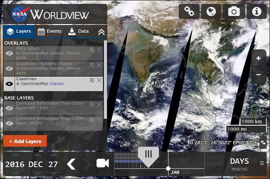
Step 1: Visit WorldView Website. You will see its interface as shown in below screenshot.
Step 2: Choose a layer by clicking on Add Layers button. A popup will be displayed, showing various categories of Science Disciplines, and Hazards and Disasters. See the below screenshot.
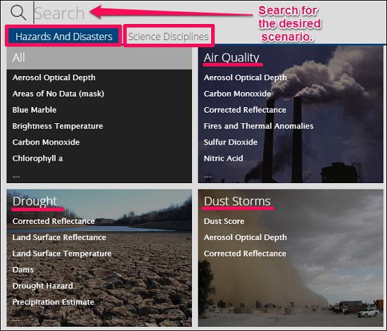
Step 3: Choose any phenomenon from the category and then select sub category by checking on its name. You will see the corresponding imagery will be displayed on the screen.
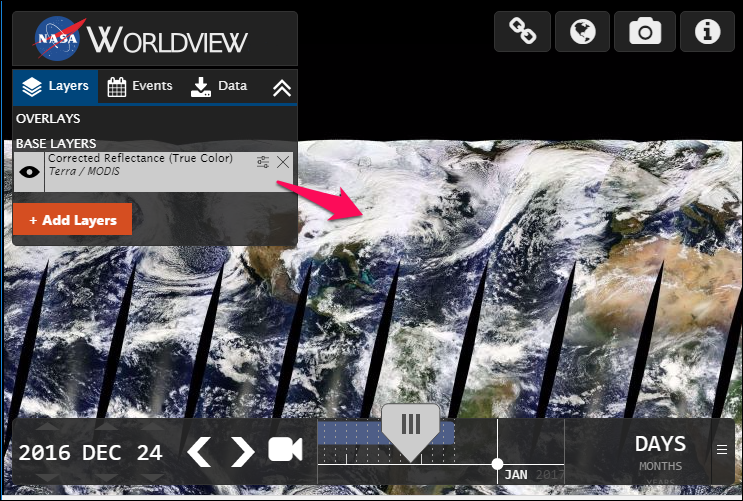
In this way, you can view any phenomenon as a real-time imagery captured by NASA’s Earth observing satellites. You can add multiple layers showing different phenomenon and separately switch between them by turning any of them on and Off. Additionally you can also set the opacity of the each layer to get the combined view of all layers to have a good visualization.
How to Download Real-Time NASA Satellite Imagery Using WorldView ?
Above I explained how to view real-time NASA satellite imagery using WorldView. Apart from viewing and browsing the imagery in real-time, you can also take a screenshot of any part of the imagery or download it entirely.
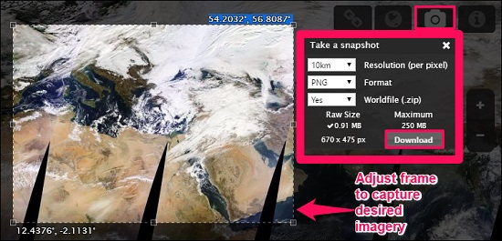
To take a screenshot, first browse to the desired location whose screenshot you want to capture. Next, click on camera icon from the top right side of the window. A frame will appear that you can adjust on the screen to download the final image as standalone JPEG in high-resolution or as a compressed ZIP file. See the below screenshot.
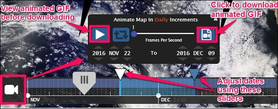
The screenshot is not just limited to images only; you can also download an animated GIF to view the imagery during specific period. To download an animated GIF, click on video icon from the bottom and then specify the frame rate and two different dates among which you want to see the animated imagery of phenomenons. See the following screenshot.
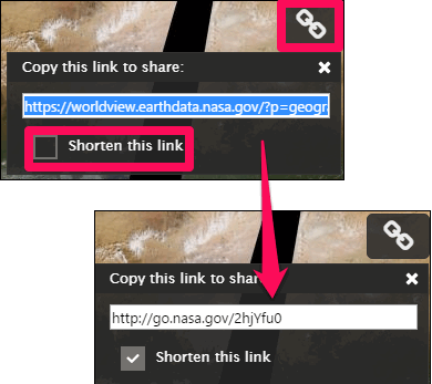
If you want to share the Map that you are currently viewing, then you can share the same view with others using a link. To do this, click on the link icon given next on the top right position. A small popup will appear with link of the imagery that you were viewing.
The link that it provides for sharing is generally very long, so it also provide an option to shorten it from the same popup. See the below screenshot.
Overall, I really enjoyed browsing real-time imagery using WorldView. And What I really like about it is that it provides you real-time view of various phenomenon that are going on Earth. This tool can be useful to create geographical reports of various regions.
My Final Verdict
I find WorldView by NASA is really useful tool to collect, download data, and view images of real-time scenarios of Earth. Just go to WorldView website and start enjoying real-time NASA imagery.